Map Poster Printed Material
K - 12th
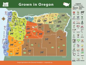
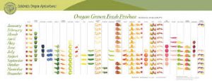
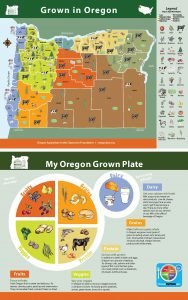
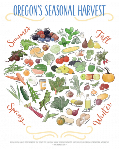
This beautiful 36 X 24 inch full color Oregon map features the leading and unique commodities grown in the state’s seven regions. It is an excellent tool to bring the story of Oregon’s agricultural diversity to the classroom.
The Grown in Oregon Map helps students visualize where things are grown in our state and why. It is a great tool for teaching regions. It can be used to learn about counties, or for starting a discussion on nutrition and the abundance of healthy produce in our state.
Maps are free to Oregon teachers. This item does not need to be returned.
Non-teachers pay $10 for shipping and handling costs. To order map, Click HERE