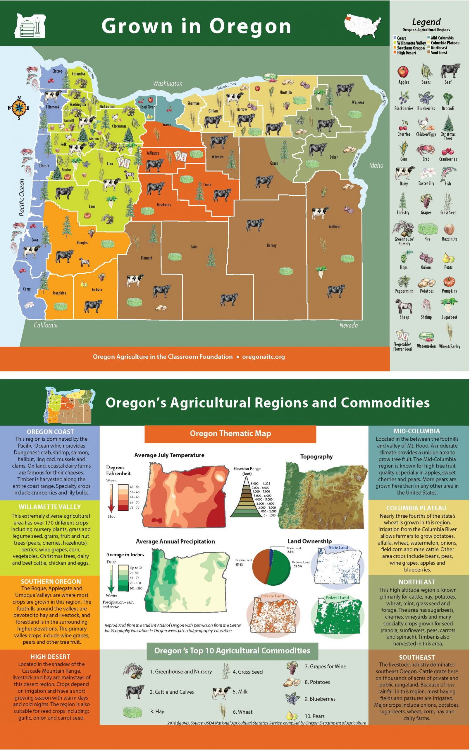
Welcome to Oregon Agriculture in the Classroom's "Teacher's Corner"! Use this page to easily find resources and materials for your classroom. Lesson plans, commodity pages and Get Oregonized history books are available to help make teaching agriculture in your classroom a success! Utilize the "Grown in Oregon" map to teach students about regions, counties and the diversity of agriculture in Oregon. Keep checking back as resources will continue to be updated!

Explore Oregon's vast agricultural diversity with our interactive "Grown in Oregon" map! With nearly 35,000 farms covering 16.3 million acres, the state produces more than 220 different agricultural commodities. By exploring our map, students will learn about the 30 commodities featured on the map, discover the diverse climate and geography in Oregon and how that relates to agricultural production, and watch virtual and educational videos of how food, fiber and products are produced on local Oregon farms.
View MapThe beautiful printed version of our "Grown in Oregon" map is an excellent tool to bring the story of Oregon’s agricultural diversity into the classroom. The map helps students visualize where things are grown in our state and why. It is a great tool for teaching about regions and counties. It's also an excellent way to start a discussion about nutrition and the abundance of healthy produce in our state!
Order Map - 36" X 24" Download Map - 8" x 11"